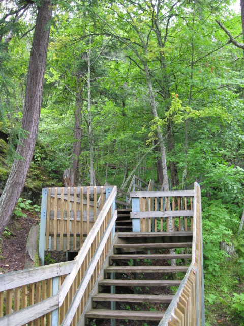
'Trail' up Summit Peak.
Michigan Highpoint - Mount Arvon - 1979.2 ft
23 Aug 2010, 1:48 pm. Highpoint #41.
Summit Peak - 1958 ft
The 'official' Michigan state high point has changed several times, seemingly every time a new survey was conducted. To make sure we weren't cheating, Tom Buckley and I decided to reach each of them (the last three, anyways), in chronological order. First up was Summit Peak, 1958 feet, in the Porcupine Mountains. This was thought to be the state high point until the late 1950's. It didn't even really have a name then, and was known only as 'the peak one mile south of Mirror Lake'. In 1956, the name 'State Summit' was proposed, but it was soon discovered that Mount Curwood and Mount Arvon were actually higher. (That survey pegged Curwood as the highest point in the state.)
Summit Peak is also the highpoint of Ontonagon County. We basically followed the directions of Bill Schuler provided on the County Highpointers Association webpage. From Silver City, we drove west on Highway 107 for about three miles, then turned left (south) on South Boundary Road soon after entering the Porcupine Mountains Wilderness State Park. After stopping at the visitor center to get our $8 day permit, we continued along the road, first south and then west, for about 12 miles. Then we turned right onto Summit Peak Road, and followed it for 2 miles to the parking lot and trailhead. There is also a trailhead one mile up the road, it is for overnight use. You could also get to the peak from this lower trailhead, the hike would be somewhat longer and with more elevation gain. This was a very easy hike, with most of the 'trail' being a wooden boardwalk. There is an observation tower at the summit, and a platform a little below it, but while we were there, it was cloudy enough that we didn't have much of a view. We reached the summit at about 5 pm on 21 Aug 2010.

'Trail' up Summit Peak.
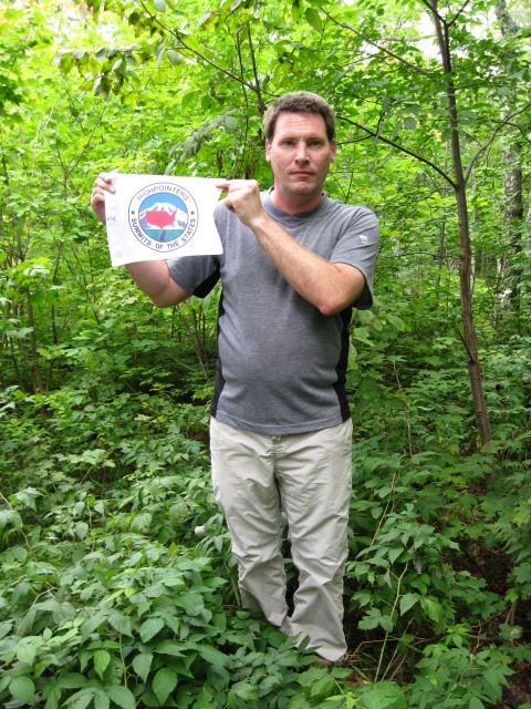
Me at the top of Summit Peak, just next to the observation tower (not in view).
Mount Curwood - 1978.2 ft
Next up was Mount Curwood, which was thought to be the state highpoint until around 1982. Curwood was the most difficult of the three. The route is similar to that up Mount Arvon, mostly a drive on unpaved logging roads, but since Curwood is no longer considered the state highpoint, the roads were more obscure, and less well marked. We followed the directions of Roy Schweiker, also from the County Highpointers Association. I have reproduced these directions below.
0.0 Start at Tourist & Recreation Association 755 E. Broad St. in L'Anse (right where US-41N swings left). Go south on US-41.
0.6 Go left on Dynamite Hill Road and follow its twists and turns.
4.1 Pavement ends. Go right at the fork. This is Silver Road. (Arvon Road goes left although sign is on the right.
Note that this is not a good approach to Mt. Arvon.) There are blue diamonds at some intersections but no label that they point to Mt. Curwood.
Stay on main road and avoid side roads.
6.9 "Greenhouse". Power lines end and road less traveled beyond.
11.2 Turn right and cross bridge. Road is now one lane but still OK.
11.7 Turn left and then right at fork just beyond, grass in center much of way beyond.
15.3 Go left at clearing with parking space. Road is muddier with more ledge beyond, although a careful driver in a passenger car might make it.
16.0 Cable and snow fence across road. Go left on ATV trail 100 yards to summit with benchmark and CMC register in rusty mailbox. Marker in concrete slightly above ground level.
Roy's directions were basically still appropriate, and most of my comments are in relation to his directions. I also measured some GPS coordinates along the route, which are listed below. Everything was very straightforward until the turn at the 11.2 mile point. There was a new road under construction just past the correct right turn here. At the time it was obviously not the correct road, but when completed, this may be more confusing. A couple of miles past this turn, I made the one navigation mistake of the day, at a fork in the road at the waypoint CW-STRAIT. One way turned to the left, and the other continued straight. I thought the way left looked more traveled, so I made the turn. This wasn't correct, however, but we were soon bailed out. Just after this turn, a pickup truck came up behind us, and they were able to set us straight as to the correct road. At CW-PARK, we decided to park the car and continue on foot. The road wasn't really that bad, but with the rental passenger car we were driving, I didn't want to take too many chances. There were a few mosquitoes around as we parked the car, so I sprayed on the DEET before starting to walk further up the road.
We didn't see much in the way of any markings along most of the way to Curwood, although in the shadows they may have been hard to see. However, at CW-BLUE there were several spots of blue paint, some on trees and rocks to the right of the road, and some on the road itself, indicating that this was indeed the right way. About 2 miles or so past our parking spot, the road ended at a cable and orange plastic mesh fence. The words 'across road' in Roy's directions sort of suggested the existence of a road past the fence, but the path beyond would be better described as a 'mud pit' than as any kind of road. At this juncture, an obvious trail headed to the left, which we followed for perhaps 100 feet, to the summit of Mount Curwood, at 10:55 am, on 23 Aug 2010. There was a register and a log to sit on at the summit.
There is not very much relief at the summit of Curwood. It doesn't feel like much of a peak at all. On the drive out, we saw a porcupine walking off the road. It would have fit in better near Summit Peak, where the mountains were named after it, but we were pleased to spot the interesting creature.
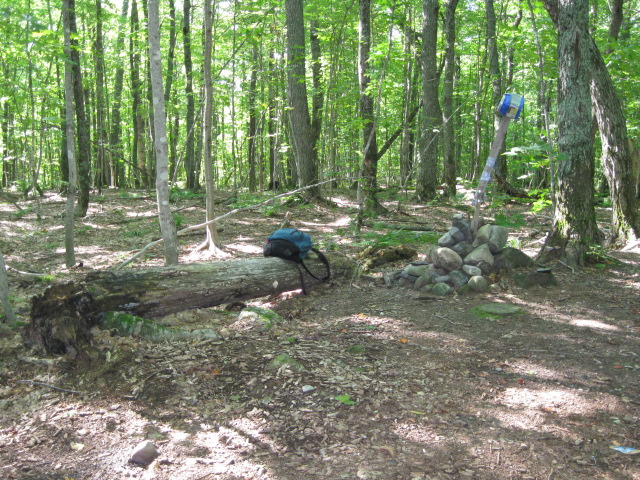
The summit of Mount Curwood.
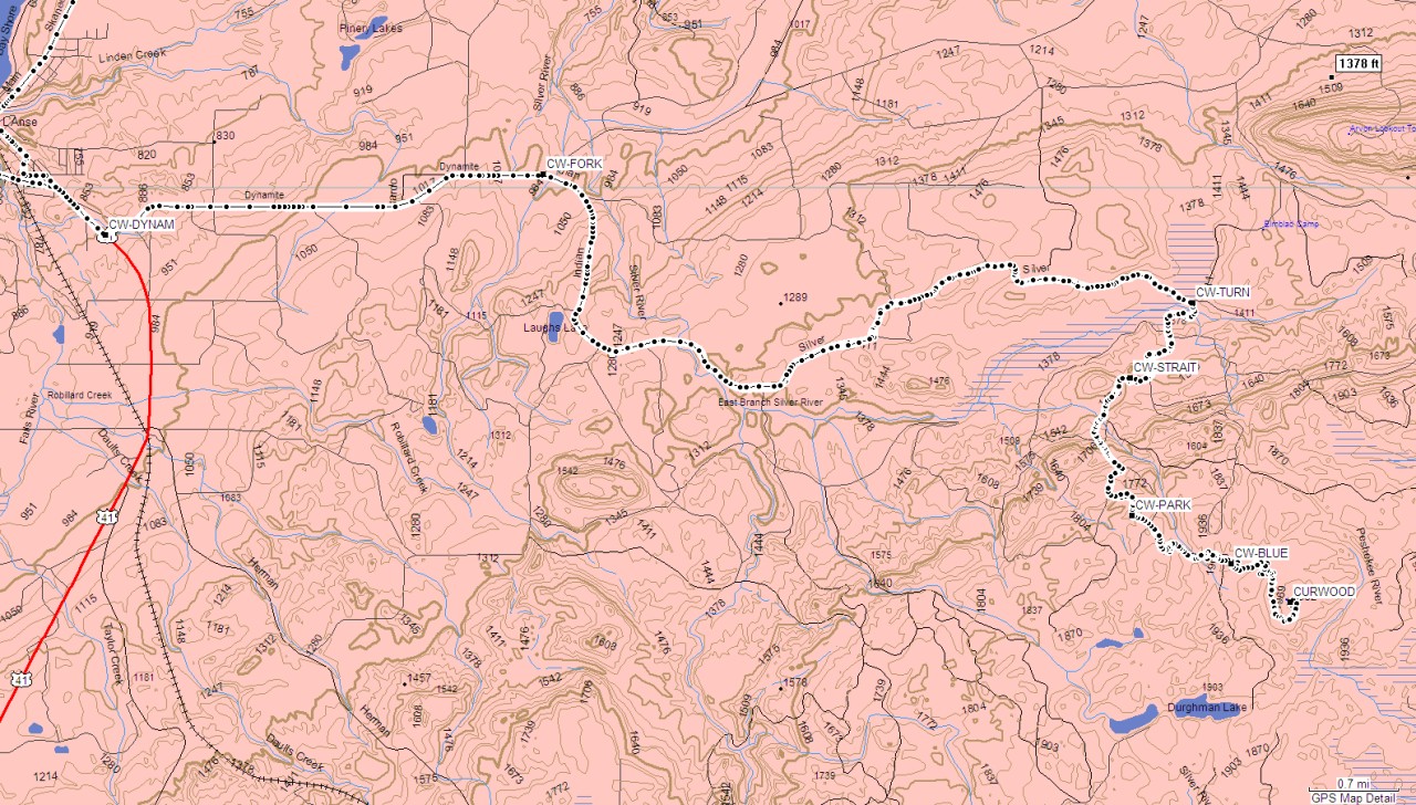
GPS map of our route up Curwood.
Waypoints along route to Mount Curwood
| Name | Coordinates dd mm.mmm | Notes |
|---|---|---|
| CW-DYNAM | N46 44.679 W88 26.127 | 0.6 mi - Turnoff onto Dynamite Hill Road. |
| CW-FORK | N46 45.093 W88 21.793 | 4.1 mi - Go right at fork onto Silver Road. |
| CW-TURN | N46 44.216 W88 15.351 | 11.2 mi - Turn right here and cross bridge. |
| CW-STRAIT | N46 43.705 W88 15.967 | Go straight at this fork! |
| CW-PARK | N46 42.772 W88 15.948 | We parked here. |
| CW-BLUE | N46 42.442 W88 14.969 | Blue blazes on the side of the road. |
| CURWOOD | N46 42.184 W88 14.380 | Summit of Mount Curwood. |
Mount Arvon - 1979.2 ft
Finally, just after finishing Curwood, we moved on to the (current) official highpoint of the state, Mount Arvon. We basically followed the directions provided by Indian Country Sports, which are reproduced below.
Approach: From the intersection of US Hwy 41 and Broad Street immediately South of L'Anse, proceed north into L'Anse on Broad Street for 0.7 miles to Main Street. Turn right on Main Street which will become the Skanee Road, and continue 16.1 miles to Church Road (formerly Roland Lake Road) on the right, where the Zion Lutheran Church is on the SE corner. (Note - We saw this road labeled as Roland Lake Road, not Church Road.) Turn right on Church Road and proceed 2.9 miles to Ravine River Road to Roland Lake. Turn right on Ravine River Road and continue 6.1 miles to T-intersection. Turn right and continue 0.9 miles to the trail on the right which actually is an old logging road.
The route on Ravine River Road is as follows: At 0.7 miles, fork, go straight; 1.8 miles, pass through gravel pit; 2.0 miles, leave gravel pit at a fork, go straight; 3.0 miles, fork, bear left; 3.4 miles, fork, bear right; 4.0 miles, 4.5 miles and 4.7 miles, forks go straight; 6.1 miles. T-intersection, main road goes left, turn right, 6.3 miles fork, go left; 6.4 miles, steep incline at the point, fork, go right; 6.8 miles, fork, go right 7.2 miles go to right. At this point there is a parking lot and there is an approximately 1/4 mile walk to the summit. A USGS benchmark and mailbox containing a register will be found on the summit. Return down the mountain the same way.
Generally, we tried to stay on the main road, which was pretty obvious, and we didn't worry much about the details of all the forks. There are supposedly blue diamond signs to mark the route, but we only saw a handful of them. A little bit before the parking lot, at the sharp right turn after the T-intersection, we parked the car, as there was water on the road past this, which I didn't want to get stuck in. Otherwise, this would probably still be passable by a passenger car. We followed the gravel road uphill, past at least one snake who was guarding the summit. This section was considerably steeper than the final part of the hike up Curwood, although that is not saying much. Near the end, there was a gate followed by high bumps in the road, which seem to be intended to discourage people from driving the last bit. Really, I don't know why anybody would want to drive all the way to the summit. I like to actually walk (at least) to my highpoints, and it certainly isn't worth getting your vehicle stuck to skip a half mile walk.
The sign at the summit lists the elevation as 1979.238 feet, but this accuracy seems overly optimistic to me. There are several benches at the summit, and we stopped for lunch (and a little mosquito swatting), then returned the way we came.
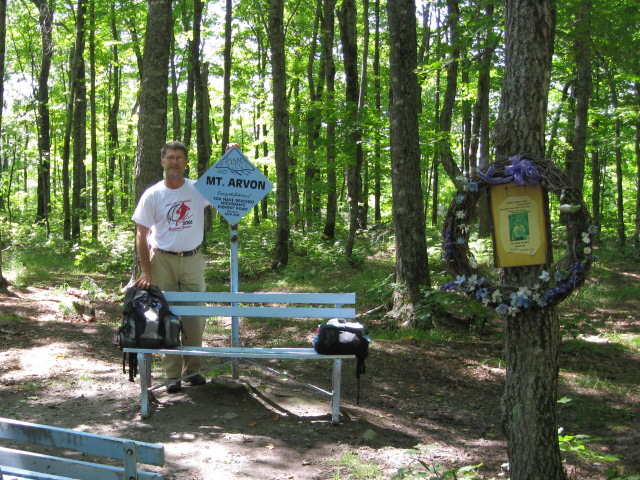
Tom at the summit of Mount Arvon.
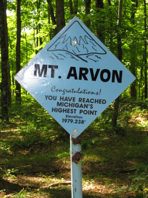
Optimistic precision on the sign at the summit.
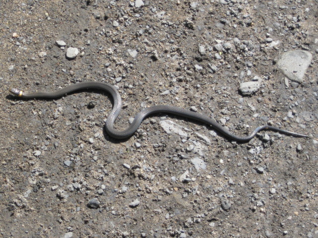
Mount Arvon resident. Possibly a ringneck snake, or perhaps a juvenile brown snake.
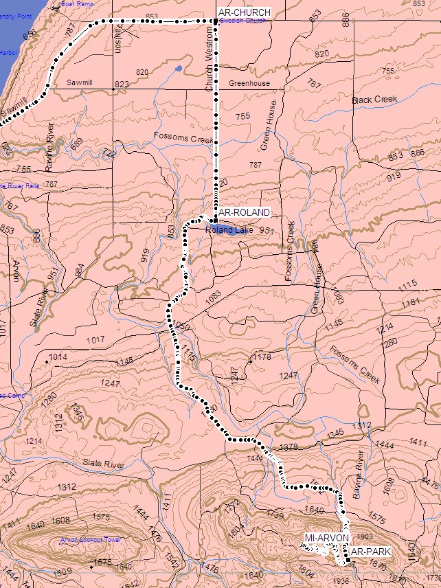
Map of route to Mount Arvon.
Waypoints along route to Mount Arvon.
| Name | Coordinates dd mm.mmm | Notes |
|---|---|---|
| AR-CHURCH | N46 51.968 W88 10.926 | Church at turnoff from Skanee Road. |
| AR-ROLAND | N46 49.451 W88 10.927 | Turn right here. |
| AR-PARK | N46 45.164 W88 08.483 | Road turns right, we parked here. |
| MI-ARVON | N46 45.348 W88 09.322 | Summit of Mount Arvon. |
The real lesson I learned from the Michigan highpoint hikes, though, is that you would make a very serious mistake if you came to the Upper Peninsula for nothing besides the state highpoint. The highpoint hikes were pretty crummy walks, to be honest. Summit Peak was the nicest of the set, but the constructed boardwalk did take some of the wilderness feel away. As far as Curwood and Arvon go, walks along unpaved gravel roads, with a dose of mosquitoes, are far from my favorite kind of hike. But the UP is absolutely, certainly, worth the visit. Everywhere else we went was beautiful. Lake Superior, wonderfully clear and clean, stood out as magnificent. Late summer to early fall seemed like a good time to visit. The bugs really weren't too bad during our visit, and if we had waited a couple more weeks, they probably would have been even less of an annoyance. (Early summer might be miserable though.) It would probably be interesting to visit in the winter. Supposedly, Superior keeps the region from getting too cold, but there is a tremendous amount of snowfall.
References
Highpoint Adventures, Charlie and Diane Winger, Colorado Mountain Club Press, 2002.
Highpoints of the United States, Don W. Holmes, University of Utah Press, 2000.
Indian Country Sports provides a document with
directions to Mount Arvon.
(Note that the coordinates of the summit are incorrect in this document. It lists the summit at 45 degrees N, where it is actually 46 degrees.)
Directions to Summit Peak by Bill Schuler.
Directions to Mount Curwood by Roy Schweiker.