

Michigan - Upper Peninsula
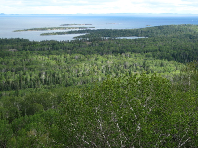
In Mid-August 2010, Tom Buckley and I headed towards the Upper Peninsula of Michigan, with the nominal objective of adding the Michigan state highpoint, (with a warm-up stop so Tom could claim Timms Hill in Wisconsin), but mainly with the goal of seeing the Upper Peninsula. I had picked up a copy of Michigan: Off The Beaten Path, by Jim DuFresne, published by Globe Pequot Press. This book only had a couple of chapters on the Upper Peninsula, but they were very well done, and suggested a number of hikes and other stops that we both enjoyed, so this book was well worth the $15 price.We started out along Black River Drive, CR 513, north from Bessemer. There are a number of waterfalls a short walk away from the road. The hikes were typically about a quarter mile on a level trail, followed by a considerable wooden staircase down to the falls. It is also possible (we didn't do this), to hike along the river, on the North Country Trail, which also passes by these falls. There is a campground at the end of CR 513, on the edge of the lake, giving me my first view of Lake Superior.
|
|
|
| The day started out misty and cloudy, but soon cleared up. | The water is brown colored from tannin from the trees. |
After checking out the falls, we headed to Porcupine Mountains State Park. DuFresne had mentioned that the park had backcountry cabins for rent, some of which were reserved a year in advance. We didn't have that kind of advanced planning time, and I didn't know what cabins to get anyways, so I figured we would just head to the park and see what we could get. We didn't get to the park visitor center until mid-afternoon, and the woman at the reservation desk implied that we were fools for expecting any cabins to be still available, but there were in fact a few still open, so we chose a 2 person cabin on Mirror Lake, handed over our fee, and got keys to the cabin.
First though, we wanted to hike up to Summit Peak, which was once thought to be the state highpoint. (The official Michigan state highpoint has changed several times, as improved surveys were done.) This was not far from our cabin, the trailheads were within a mile of each other. The Summit Peak trailhead was about two miles up Summit Peak Road, but this is not open for overnight parking. So, after completing the short hike, we drove down a mile to the overnight trailhead, loaded up our packs, applied a liberal coating of DEET as a wave of mosquitoes attacked, and headed onto the South Mirror Lake Trail.
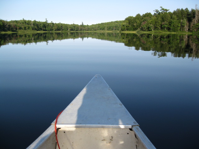
At first, the trail was an old unpaved road. After about 1.5 miles, it intersected with a trail that went up to Summit Peak the back way, but we continued on towards Mirror Lake. The trail became a normal single-track path, marked with blue blazes, and after another 1.5 miles we reached the lake, with the Mirror Lake 2 cabin just beyond. The cabin was very nice, equipped with a bunk with two beds, mattrresses, a wooden table, pots and pans, some maps of the lake, and various other things. The cabin, like most, had its own boat, ours was a canoe, tied up perhaps 100 meters from the cabin. We had a couple of hours until sunset, so we took out the canoe and paddled out onto the lake. The lake lived up to its name, with an almost perfectly calm surface. In the evening light, the reflections were magnificent.
 |
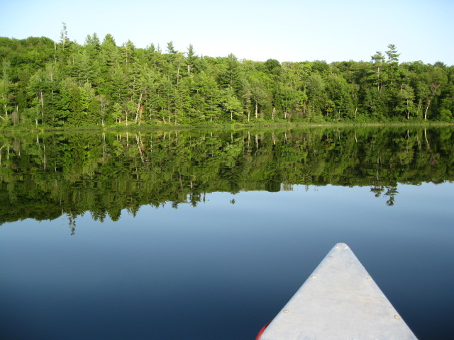 |
| Mirror Lake lived up to its name. | |
The next morning, we headed towards Lake of the Clouds, first heading east along the lake, then northeast and then north along the North Mirror Lake Trail. Parts of this trail were pretty muddy. About halfway into the approximately 4 mile one way distance, the trail started a fairly steep descent over some rooty terrain, as it descended through a notch in the terrain, on the right side of a stream valley. Soon after this descent, we reached the west end of the lake, crossed a bridge, and climbed to the overlook above. There is a road leading to this overlook, many visitors to the park just drive to the viewpoint. We did see several backpackers, some of whom were straining up the steep ascent from the lake to the overlook. The late morning light wasn't the best, the sun was in your eyes and so there was a lot of glare. After checking out the view, we returned the way we came, packed up our gear at the cabin, and hiked back to our car.
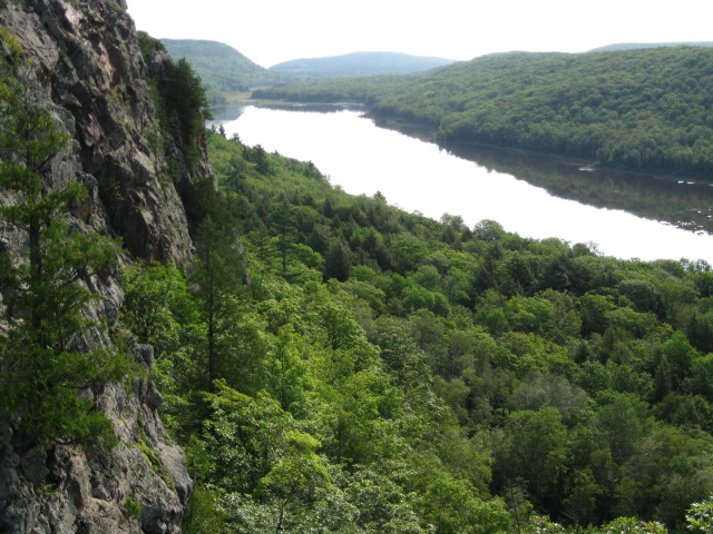
The standard view of Lake of the Clouds. Evening would provide better light.
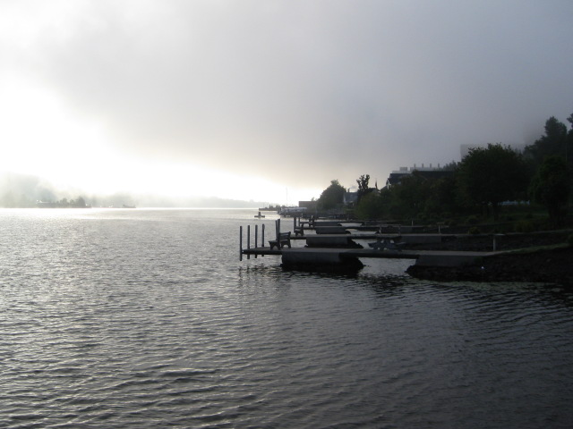
The next goal on our list was to claim the true highpoint of the state. After leaving Porcupine Mountains, we drove on to the Super 8 in Houghton. The motel was at a very nice location, right on the edge of the canal, which divides the main part of the Upper Peninsula from Copper 'Island' to the northeast. (This is not really a true island, as the canal is artificial.) There was a walking path along the canal, along with many public docks (damned socialism!) with benches so you could sit and watch the water. The National Park Service ferry to Isle Royale was just a couple of blocks to the west, and just past that we stopped for dinner at the Library, a brewpub. We decided that a growler to go was the most efficient use of our beer drinking dollar, since we expected to be able to stop back several times over the next few days for refills, and all of the ones we tried were very good.
 |
 |
|
| Looking north to Copper 'Island'. It looks like there is downhill skiing in winter. | Docks along the edge of the canal in front of the motel. |
The next morning we finally set out for the state highpoint. As mentioned, this title has been assigned to several places over the years, and first we aimed for Mount Curwood, which held the title until 1982. This is mainly a drive over unpaved logging roads, and since Curwood is no longer the official holder, there were not any signs, and the way was obscure. But we did finally get to see a porcupine on the drive out. Then we finally claimed Mount Arvon, the current official highpoint, with a somewhat similar, but much less confusing, drive. With our 'summit' in the bag, we headed back to Houghton to prepare for a trip to Isle Royale National Park.
There are a few different ferries across Lake Superior to Isle Royale. The Ranger III, the NPS ferry from Houghton, was docked right near to our motel, but that ship does not travel every day (it takes about 6 hours each way), and it didn't meet our schedule. Instead, we took the Isle Royale Queen from Copper Harbor, a faster ship that takes only about 3.5 hours each way, and runs every day. (The prices for the two are comparable.) These both land on the east side of the island, at Rock Harbor. (There are also ferries from Minnesota that land on the west side of the island. The west side is also closer to the park highpoint, Mount Desor.) The ferry gift shop offered a brief useful, lightweight (one 8.5x11 inch card), and inexpensive ($1) trail guide to Isle Royale, Trails and Hiking Routes: Northeast Isle Royale, which had a description of several trails as well as mileage information. It was even written by our ship captain for the day, Ben Kilpela! There were several backpackers taking the trip, but most of the passengers seemed to be heading for the lodge, the only non-backcountry accomodations on the island, but which is very expensive (around $350 per day). One side effect of taking the faster Isle Royale Queen, is that passengers are more prone to seasickness, than on the slower Ranger. But you can head out on deck, to the front of the ship, and watch the waves and the horizon, which is supposed to help if you get queasy.
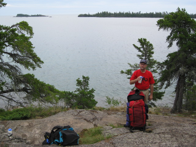
Upon landing on Isle Royale, you start with a mandatory briefing from the park rangers. One point made was that the water sources on the island may be contaminated with tapeworms, which are not destroyed by chemical treatment. Thus, the recommended options were either #1 - Use a water filter, or #2 - Boil the water. I don't have a filter (yet), but I had known this beforehand, and we had prepared for #3 - Carrying all our water, about 2.5 gallons each for two and a half days. Another bit of information was that, due to the presence of wolves near the campground, our intended destination of Daisy Farm had closed all tent sites, and you were limited to using the wooden shelters. We hadn't been sure if shelters would be available, so we had a tent with us. (This plus the water we wouldn't have needed if we had a filter meant that we carried quite a bit of extra weight!) The final interesting bit of information, was that you were allowed to eat all the wild berries that you wanted. Finally, each group has to register with the rangers, list their expected itinerary (you can vary from this), and after all that, we finally put on our packs, and headed west towards the Daisy Farm campground, just over 7 miles away.
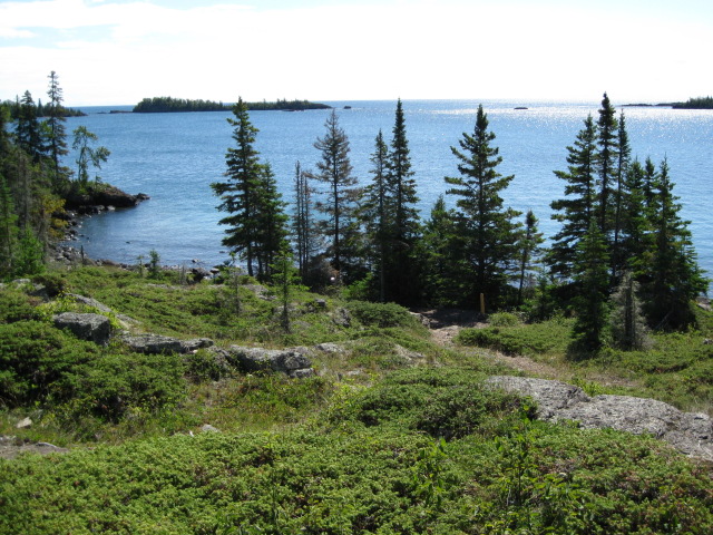
The trail to Daisy Farm stays along the edge of the lake, and the path varies from up and down over bare rock, to a trail covered by lots of roots, to a more comfortable path, with an occasional wooden boardwalk through wet sections. As we walked along this, it really sunk in how clean Lake Superior was. The water is crystal clear, without much algae, and doesn't have an unpleasant smell. The lake bottom is made from rounded rocks, usually around fist sized, of a variety of colors. The overall effect is subtle and wonderful.
 |
 |
|
| Rest stop along the trail to Daisy Farm. | Rock Harbor at the base of the spur to Suzys Cave. |
After reaching Daisy Farm, we find an unused shelter, toss our gear in, and head out to the lake to soak our ankles in the cool water. (If all the shelters were occupied, we would have to share with somebody else, but it did not come to that, and nobody needed to try and move in with us later either.) It is hard to imagine that the Lake Superior water is dangerous, perhaps the tapeworm problem only applies to the lakes on the island (which are certainly far more questionable), but this was moot point since we already had all the water we needed. One of the signs around the campground showed how to identify thimbleberries, one of the edible fruits, and a very common plant on the island, with large maple shaped leaves. The red berries look kind of like raspberries, but the cap pops off as kind of a hollow bowl, sort of thimble shaped. Now that I knew how to identify these, I made a point of eating all the good ones I could get.
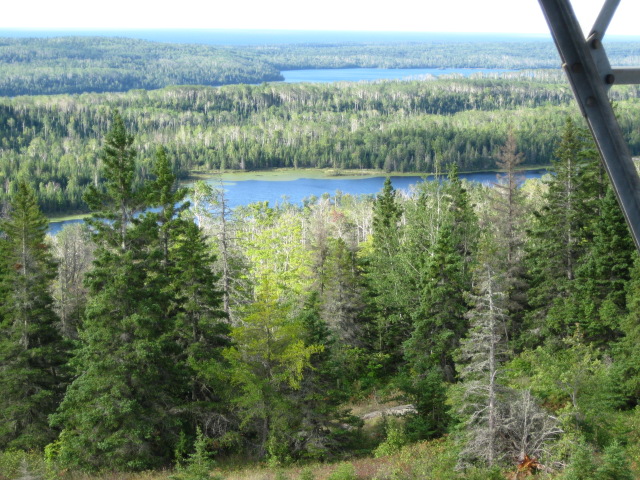
The next morning, we headed out for a loop day hike. An up-and-down ascent to the north, about a mile and a half, brought us to the top of Mount Ojibway, along Greenstone Ridge, which runs along the spine of the island. We climbed up the observation tower, which was beset with strong winds, but the view in all directions was excellent. Then we headed northeast along the ridge for about 2 miles, to Mount Franklin, a rocky outcropping that also offered good views to the north. We then headed down and south, towards Three Mile campground, but when the trail reached Tobin Harbor, we headed east for about a mile, then south and over a ridge, passing a cave, and back down to Rock Harbor. Then we turned west and headed back to Daisy Farm. I made sure to munch on all the good looking thimbleberries as we walked along. Along the way, we saw several garter snakes, black creatures a couple of feet long, with thin yellow pinstripes running down the length of their body. These snakes are completely harmless.
 |
 |
|
| View from Mount Ojibway. | It was very windy up in the tower! |
View from Mount Franklin.
That evening, a park biologist came to the campground for an interesting talk about the moose and the wolves on the island, and the great fluctuations in their populations that happen over time. We didn't see either of these animals on our trip, but there were definitely wolves near the campground, which is why the tent sites were closed. The fall is apparently a hard time for the wolves (even harder than usual), and they are forced to eat fruit, which is not normally part of their diet. The campground features an apple tree, which was part of the draw for the wolves. They also seemed to eat plenty of blueberries, which they didn't digest very well. Wolves, which are genetically very similar to domestic dogs, do not attack humans, but nobody knows why. They are certainly capable of it, as they hunt moose, which are much larger than people. If they ever change their mind, one bit of advice is not to run away. When a healthy moose is threatened by wolves, it will stand its ground, and the wolves recognize this and look elsewhere. The weak moose run, however, and the wolves chase, and eventually bring it down. The next morning, we packed up, hiked back to Rock Harbor, took the ferry back to the mainland, returned to Houghton, and made another stop at the Library.
We took the next day off from hiking to check out some historical sites on the 'island'. Tom spent the day checking out the buildings in Houghton and Hancock, while I was interested in the mineralogical history of the area. The Keewenaw peninsula region is remarkable as one of the few places in the world where pure copper metal is found naturally in large amounts. Almost everywhere else copper is mined, it is as a chemical compound, and 'ore'. The metal was formed around one billion years ago, as ancient lava flows cooled, with parts very rich in copper. Some 7000 years ago, people started mining the metal. The rocks on Isle Royale are part of this copper bearing area, and mining took place on the island from 4500 years ago until the 19th century. There has also been a lot of iron mining in the Upper Peninsula, and unlike with copper, this mining is still taking place. The first stop was the A. E. Seaman mineral museum, located (for now) on the Michigan Tech campus. They had a very nice collection of copper specimens, in all kinds of shapes, as well as silver (which occurred with the copper in the Keewenaw), as well as hematite (iron ore) specimens, in an amazing variety of forms. The museum gift shop had a nice selection of copper and other minerals, many of which were very reasonably priced.

Loot from the Michigan mines. Hematite at the left, silver at top, and several copper pieces.
After the museum, I stopped by the Quincy mine, just north of the canal in Hancock, and finally the Delaware Mine, farther north towards Copper Harbor. The Quincy mine had a tour into part of the mine, as well as of the impressive hoist machinery, and also an interesting gift shop. The Delaware mine had a self-guided tour, and as there was nobody else there when I was, I got to wander through the tunnels alone, which was kind of eerie. You could also hunt through the rocks on the surface for your own copper samples, and I found a couple of rocks with some green bits of weathered copper.
Finally, I rejoined Tom at the Library, where we filled our growler one last time, and headed out to watch the sun set below Lake Superior. We had hoped to camp at McLain State Park, right on the edge of the lake, just north of the canal that separates Copper 'Island'. Supposedly, the sunsets are fantastic, and the beach is nice for swimming. Unfortunately, by the time we got there around 5 pm, all the sites were taken, and we had to look elsewhere. The park employee was helpful with suggestions, and Plan B was to head north a little more, towards Ahmeek, to Sunset Bay Campground, also on the edge of the lake. Directions to the campground were to take US 41 north to Ahmeek, then turn left onto 5 Mile Point Road, and to follow this approximately 7 miles to Camp Road. Then, to turn left at the Sunset Bay sign and go about 3/4 miles to the campground. It was confusing to find the correct road in Ahmeek, I think the road was not initially labeled '5 Mile', but we eventually found the road out of the small town, and continued on towards the campground. Unlike McLain State Park, there were plenty of available spots here, so we picked one just off the rocky beach, setup our tent, and turned to the main business of consuming the contents of our last growler from the Library. Supposedly, rockhounds come to Sunset Bay to look for agates on the rocky beach.
I didn't notice too many mosquitos, but there were a fair number of stable flies. These flies look a lot like houseflies, but they have a nasty bite. For some reason, they prefer to go after the lower body. Our prescription for dealing with them, was to wade out into the lake, up to about 3 feet deep, which kept them off my legs, and my long-sleeved shirt kept them off my torso. Since they left my head alone, this took care of the problem. Meanwhile, we sipped from our cups from the growler, and only left the water when we needed a refill. We continued taking this medicine until we watched the sun go down. Of course, if the lake was not as warm as it was, this plan wouldn't have been so enjoyable, but in this case this was a delightful solution to the problem.
The next morning, we headed east towards Munising. Near Negaunee, just west of Marquette, I hoped to stop at the mythical Michigan Iron Industry Museum, to see some more of the Upper Peninsula's mineral heritage. Both copper and iron were of tremendous economic importance to the UP, and while the copper mining has ended, there is still iron mining in progress. Our book gave us directions from US 41, to turn onto County Road 492, about 3 miles east of Negaunee. We found this turn, which was also labeled Maas Street, but never found the museum. We followed 492 all the way until it rejoined US 41 in Marquette, and looked carefully for signs, but never saw any indication of the museum. Later, I found some addition directions, saying to enter from Forge Road off County Road 492 (Maas Street), across from the Negaunee cemetery. This seems to be about 2 miles from the turnoff from US 41, on the left. My map suggests that Forge Road may be unpaved at this point. This is about 1.5 miles before 492 intersects County Road 35 in Eagle Mills. There may be a new road to the museum now. Apparently, there is a new road to the museum now, which we did not know about. Supposedly, the museum is free, and open from 9:30 am to 4:30 pm daily, May through October. That is, if it actually exists. In any case, we found it very well camouflaged.
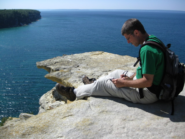
When we got to Marquette, we headed north a bit to Sugarloaf Mountain, with supposedly spectacular views. Our directions said to head north from Marquette on County Road 550 for a few miles, but we had trouble finding this road as well. After stopping at a hotel, we obtained a map and directions. There is a somewhat confusing intersection at the point where US 41/Michigan 28 turns to the south at the lake shore. From this intersection, head north, on Front Street, for 1.4 miles, until the road dead-ends at Fair Avenue. Turn left on Fair, then immediately right onto Presque Isle Avenue. After a total of 1.2 miles, this intersects Hawley Street. Turn left on Hawley, which will soon run into Big Bay Road/County Road 550. Follow this for a total of about 3 miles, and turn right into the parking lot labeled for Sugar Loaf. Here we found the trail, a short and moderately steep walk, up 315 feet on a combination of trail and wooden steps, to a rocky summit. The vista were as described, wonderful views of the lake and this part of the Upper Peninsula. This was definitely worth the effort to find.

View from Sugar Loaf mountain.
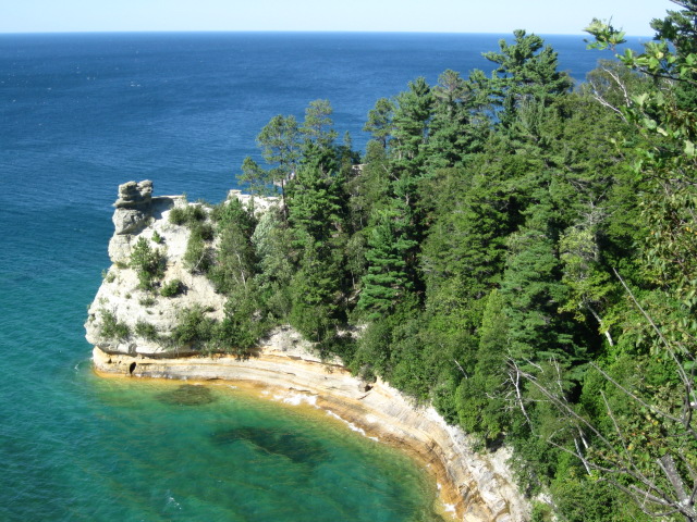
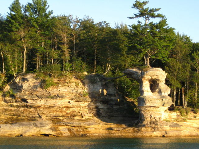
Miners Castle.
 |
 |
 |
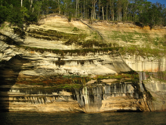 |
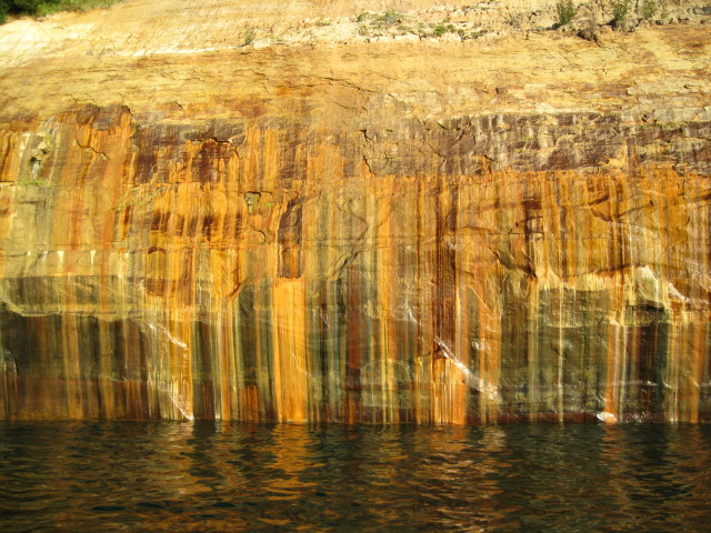
| Cliffs seen from the tour boat. | |
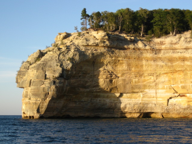
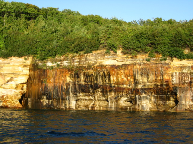
Indian Head Point.
The next morning, we set out for a hike along much of the terrain we had seen from the boat the day before. From H-58 out of Munising, we turned left onto unpaved Chapel Road, and drove about 4 miles to the parking lot. At times, the road really had a 'washboard' surface, and I had to drive really slow to limit the vibration. From the parking lot, we headed northeast to Chapel Falls, then continued to the beach at Chapel Rock, where we saw up close the remarkable tree still holding on. The trail then heads west, mostly along the edge at the top of the cliffs, passing Grand Portal Point, Indian Head Point, and other formations, with many magnificent views. There were some stable flies here, mostly out in the open on the cliffs. When the trail went inland a bit through the trees, they were not nearly as irritating. About 4.5 miles after Chapel Rock, we came to Mosquito Beach, a spot of sandstone that was a nice place to swim in the lake. Thankfully, despite the name, we saw no mosquitos, and the flies were not a problem as long as we were in the lake! After cleansing our spirit in the lake, we packed up and headed back to the parking lot. Just after leaving the beach, we saw a mink just off the trail, and it didn't seem to mind us stopping to watch it. Once we got to the car, we drove on to Newberry.
 |
 |
| Chapel Rock with its persistent tree. | |
 |
 |
| View from the cliffs. | |

Mosquito Beach.
After seeing Pictured Rocks, we had two remaining days to check out the eastern part of the Upper Peninsula. We stopped by Upper Tahquamenon Falls, a large waterfall with a shape reminding me of Niagara Falls (but not as large), and then Lower Tahquemenon Falls, a subtler cascade, seen by taking a rowboat across the water followed by a walk around a small island, before heading to Sault Saint Marie. We then toured the Valley Camp, a museum inside a 500 foot freighter. From there, we walked along Water Street to the Soo Locks, where ships transit between Lake Superior and the Saint Mary's River. DuFresne said that Water Street had been renovated into a walkway, but we found the whole thing under construction instead.
We watched a few small ships transit the locks in the afternoon, but wanting to see some larger ships, I took advantage of the schedule posted on a whiteboard in the visitor center, listing the expected arrival time of large ships. Several large ships were scheduled for that evening, so I came back to the park to watch some. First up was the Mesabi Miner, a 1000 foot freighter, heading east (and 21 feet down). This is about the largest size ship that can fit in the locks, and it must use the Poe lock, the larger of the two locks, which is further away from the viewing stand, so you can't see it as well. After the Miner passed through, another large freighter passed the Poe lock, this time heading west (and up). Finally, a somewhat smaller, but still quite large, freighter came west through the smaller MacArthur lock, just in front of the viewing stand. It was most impressive to watch the large ship rise up in the southern lock, just a few feet away. The ship takes up almost the whole area of the lock, there is very little room left over. This last ship went through the quickest of the three, presumably the smaller lock allows a faster transit.
The next morning, we headed south for a quick look at Lake Huron, then west towards St. Ignace and the impressive Mackinac Bridge, then further east, stopping briefly at Kitch-Iti-Kipi, Michigan's largest spring, which features a hand-powered raft with an observation hole in the bottom, and finally on to Wisconsin, and back home.