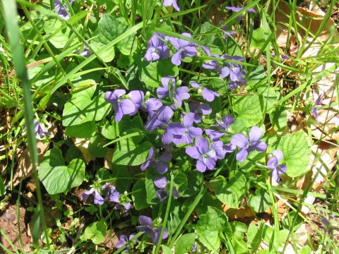
Flowers along Spring Ridge Trail.
West Virginia Highpoint - Spruce Knob - 4863 ft
8 June 2005, 7:47 am. Highpoint
#25.
Back to 2005 Northeast Highpoint Expedition
On 7 June 2005, I headed out to follow the 'Spruce Knob Summit' hike described in the Carroll/Miller book. I was glad to have the good description, it turned out, as some of the trail intersection signs were destroyed, and the good terrain descriptions helped keep me on the right path. The trailhead was well-marked with a sign and parking area on CR 29. I parked the car and headed up the Spring Ridge Trail at 11:55 am. This trail is an old road, which was pretty well overgrown for much of the way. There was no rain, but it was warm and quite humid. The trail climbed moderately for a bit more than 3 miles to the crest of Allegheny Mountain. Most of this was in trees, but there were a few open meadows as well, while some nice purple flowers decorated the path.

Flowers along Spring Ridge Trail.
I was also greeted by several chicken-like birds (which some locals called the 'sage hen'), with mostly brown feathers. They seemed to be guarding chicks: the hen seemed like it was almost trying to confront me, expanding its tail feathers into a brown and white fan, making calls to scare me off. Sometimes I also saw some other smaller birds (the chicks, I assume) scatter while this was going on. Unfortunately, I didn't get any pictures of this creature. As the trail reached the crest of the mountain, I joined the Allegheny Mountain Trail. (This point is where the route description became most useful.) I walked downhill through an open meadow, entered the forest, and headed somewhat steeply downhill. Soon the trail leveled off as it turned right, and intersected the Horton Trail. The sign was damaged and unreadable, but I did manage to get on the Horton Trail successfully. I followed this trail south, fairly steeply downhill, losing all the elevation that I had gained, until I reached Seneca Creek, about 4.5 miles in, at 2:10 pm. Seneca Creek was a great spot for a rest break. There were some pre-used camp spots right off the trail, and I found one spot with some stone chairs/backrests where I stopped for a pleasant lunch while I listened to the running water. (What is it running from?)
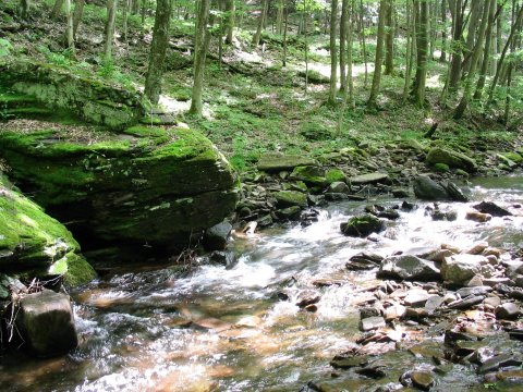
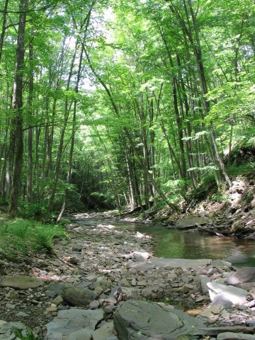
Seneca Creek.
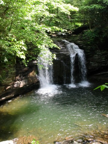
Waterfall on Seneca Creek.
After my lunch break, I forded Seneca Creek, and headed right along the trail on the far side. Soon it passed a waterfall, where I loaded my water bottles, and then met the Huckleberry Trail on the left. It was time to start uphill again! Huckleberry Trail headed steadily uphill for 3 miles, with 1500 feet vertical, or so. The trail passed some more open meadows, a few trail intersections, and was at times muddy. By 4:40 pm I reached the summit ridge crest, at another open meadow.
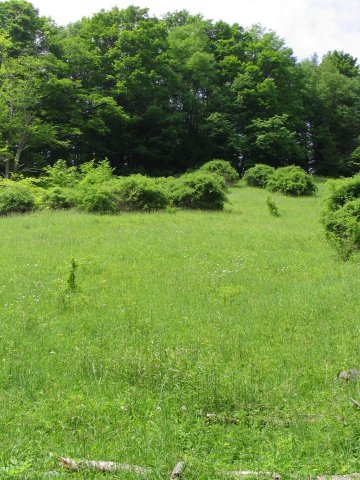
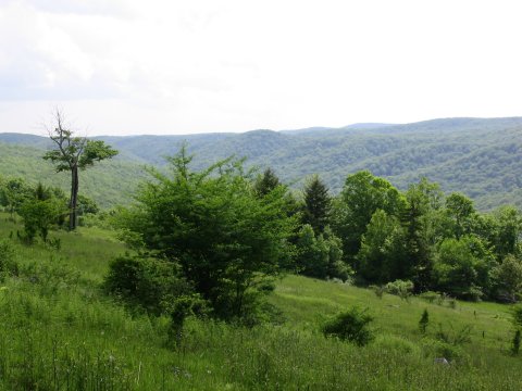
Meadows and views along the hike.
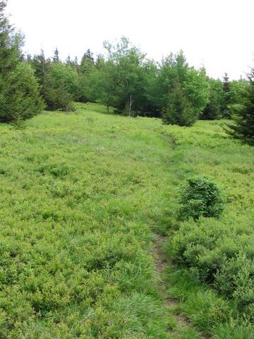
The beginning of the summit ridge.
From this point, the trail was much less steep, as it switched from meadows to spruce trees and back. There were many previously used campsites along this ridge, and I found one in the spruce trees about a mile and a half or so further along the ridge, a total of 8.5 miles in from the trailhead.
I had originally planned to skip the tent, and just bring a bivy sack as shelter. Since there had been so much rain lately, I decided to carry the extra weight of the tent. This was a fortunate decision: Although it didn't rain at all, as it turned out, the flies were pretty annoying. They didn't bother me much while I was walking, but got a lot more irritating when I sat down for dinner, trying to fly in my ears and nose and such. The tent made a nice fly-free zone so I could sleep without going nuts. With the soft spruce needles as bedding, I did sleep well. After I set up camp and made dinner, before dark, I walked a little further along the trail towards the summit, again alternating between open areas and tree cover. I passed some more flowers, and found a nifty orange salamander who was willing to pose for a photo. (I think this creature was the Red Eft form of the Red-Spotted Newt.) Although Spruce Knob is considered by amateur astronomers as one of the darkest spots east of the Mississippi River, thus great for watching the stars, I didn't stay up much past sundown so I didn't get to see the night sky show.
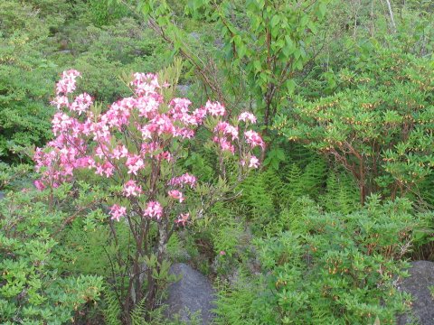
Azaleas(?) along the summit ridge.
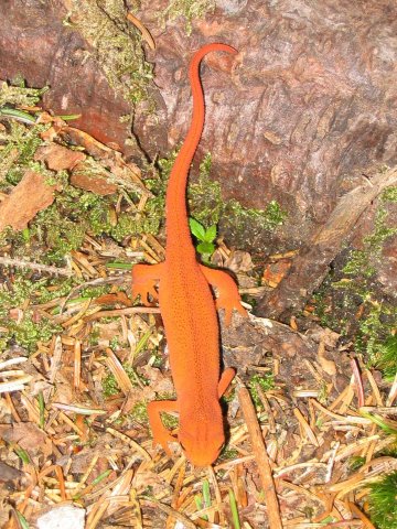
Red Eft.
The next morning, I left camp at 6:45, and started along the final 2.5 miles to the summit. Although the trail was very distinct, the vegetation was thick enough that I was pushing through brush for a lot of the way. After 2 miles or so, I stepped onto the pavement of the drive-up route parking area. I was somewhat surprised not to see anybody at all in the parking lot, but that was fine by me. By 7:47 am, I reached the observation tower on the summit. I was a little disappointed at how hazy the sky was, it took some of the luster off of the nice views. Besides the views from the tower, an interpretive trail that headed to the west quickly led to a fine viewpoint.
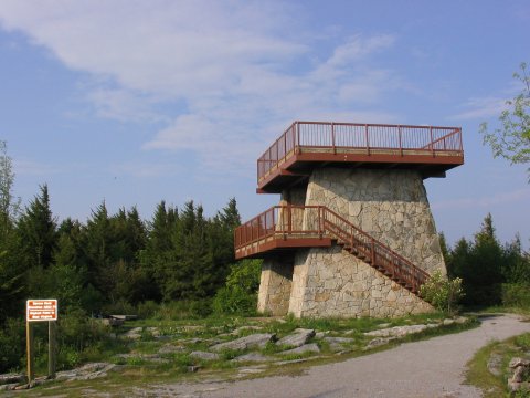
Observation tower on the summit.
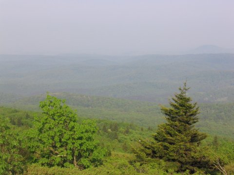
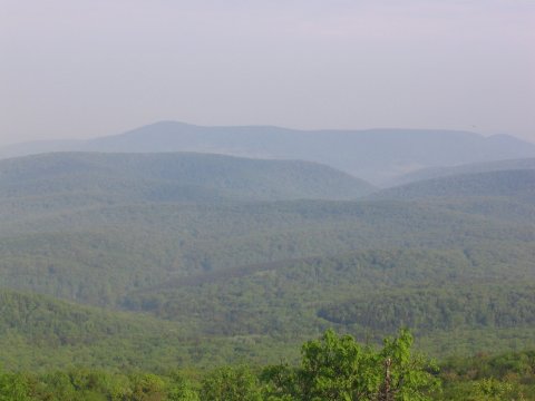
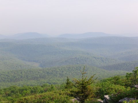
Views from near the summit. Unfortunately, somewhat hazy.
After taking in the view, I headed back to my camp, packed up, and started back the way I had come. Along the way, I saw a green striped snake scooting away from me. A little before noon, I came back to Seneca Creek, where I refilled my water bottles, forded the creek, and took another long lunch break at the same camp spot. (I went through plenty of water, almost 8 liters, on this hike.) I then started back up the climb to Allegheny Mountain, then followed the Spring Ridge Trail down to the car, reaching it at 2:34 pm. About 15 minutes before the end of the hike, I passed a couple of backpackers, the only other people I saw the whole time.
After returning to the car, I drove on to Harrisonburg, VA, stopping briefly at Seneca Rocks to take a look at the huge rock face that makes this area popular with climbers. Driving through the rolling hills of West Virginia was very pretty, this state had the best views from the car that I had on this trip.
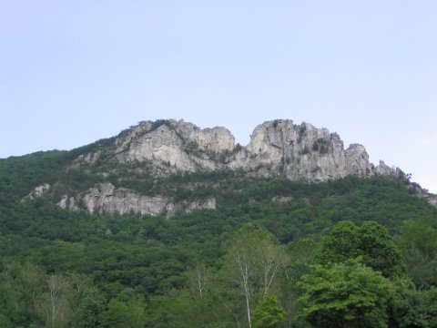
Seneca Rocks.
References
Hiking West Virginia, Steven Carroll and Mark Miller, Globe
Pequot Press, 2003. Hike #68.
Highpoints of the United States, Don W. Holmes, University of
Utah Press, 2000.
http://americasroof.com/wv.shtml
http://wvweb.com/www/nra/