
Unpaved road to the trailhead. TURNOFF is the turnoff from US 6, CAMP is the end of the 2WD road, and TRAIL is the end of the 4WD road.
Back to Highpoint Index
Back to Nevada
Some maps and waypoints from the Queen Canyon Mine route to Boundary Peak NV. These are based on GPS readings from our trip.
Waypoints
TURNOFF US 6 N37 55.588 W118 24.111 - Turnoff from US 6 onto
unpaved road
CAMP N37 53.356 W118 19.061 9107 ft - End of 2WD road, where we camped
TRAIL N37 52.854 W118 18.881 9903 ft - End of 4WD road and start of single-track
trail
TC SADDLE N37 51.785 W118 20.766 10803 ft - Trail Canyon Saddle
SUMMIT N37 50.767 W118 21.077 13149 ft - 'Summit' of Boundary Peak
Maps
Unpaved road to the trailhead. TURNOFF is the turnoff from US 6, CAMP is
the end of the 2WD road, and TRAIL is the end of the 4WD road.
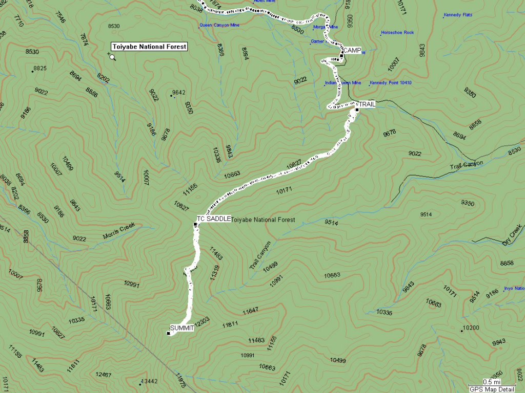
Hiking route to the summit. CAMP is where we parked and camped.
TRAIL is the end of the 4WD road and start of the single-track trail.
TC SADDLE is Trail Canyon Saddle, and SUMMIT is Boundary Peak.
Total of 10.5 miles round-trip, net elevation gain of 4040 ft.