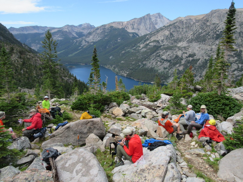
A rest stop about halfway up the switchbacks from Mystic Lake.
Montana Highpoint - Granite Peak - 12799 ft
Tue 9 Aug 2016, 9:25 am. Highpoint #43.
To coincide with the 2016 Highpointer Club convention in Red Lodge, MT, I decided to sign up with Jackson Hole Mountain Guides, for a climb of Granite Peak just before the convention, to be followed with a climb of Gannett Peak just afterwards. Our plan was to climb the standard East Ridge route in four days.
The group met up the morning of Sat 6 Aug, at Sunlight Sports in Cody. First Laurence and I met Kenny Gasch from JHMG, and then we met our guides Nadav Oakes and Chris Brown, and then the rest of the group, James from NY, Roger from VA, Chris and Al from NH, along with Laurence and myself. We would later meet our third guide Cat Coe, and also our porter Cade. The first step was getting personal climbing equipment like a harness and helmet. It cost nothing extra to get these from JHMG, but it was nice to have these myself, so that I knew that they fit and that I was familiar with them.
Then we drove off for a rock climbing practice session. We drove west on US-14 towards Yellowstone, to the first tunnel just outside of Cody. We parked here, and walked through the first two tunnels, to the climbing area on the right side of the road. It was a little nerve-wracking to walk through the narrow tunnels, with all the big RVs on the road to Yellowstone, but the walk was not far. The climbing area was a cool alcove of rock, with just a few yards of road frontage but actually quite a lot of space and routes for climbing. Nadav and Chris gave us a lecture on knots, and then we started on the actual climbing practice. Nadav led climb a pitch, and set up a toprope anchor. Then each of us climbed this route, with Nadav on belay. It was a fun route to climb. There was a spot where you had to move with just feet and balance, with no hands, and then variety of different moves. After this, we practiced roping up as a team of three. In the front was one guide, then a good distance of rope, then two clients, with only eight feet or so or rope between the last two of us. The idea was for the two of us to climb simultaneously, keeping slack out of the rope. We then went up and over a smaller and lower-angled face, and then got lowered down on belay back to the bottom.
After the climbing instruction, we had lunch, then returned to the store in Cody for a gear check, and met Cade. We had a group water filter, but I decided to being some chlorine dioxide tablets just in case since they were so small and light. Nadav gave us the driving directions to the trailhead, which were somewhat complicated, and are not in the Winger or Holmes books. It would have been handy to have this printed out, it is a pain to follow the very minor roads on map software. Then we split up for the evening. Some of the group went on to Red Lodge for the night, but Laurence and I stayed in Cody.
We only had a slightly early wakeup on Sun 7 Aug. Laurence loaded his pack into my car, and we drove off to the trailhead. The route from Cody to Red Lodge was simple. As we drove through Red Lodge, we saw the rest of the group on the street, getting ready to leave themselves. Past Red Lodge, the driving directions became more complicated. I think that we took State Road 78 from Red Lodge to Roscoe. Where the hell is Roscoe? Then we turned off onto an unpaved, but well-maintained road. I think that we took West Rosebud Road, then Ingersoll Creek Road, then West Rosebud again, with a paved part in the middle of that. It was probably 20 to 30 miles on unpaved roads. This led us to the trailhead near Mystic Lake. We all arrived at the trailhead parking lot at about the same time, including Cat who we met here. We each got our own load of group equipment and food, which was a little lighter than normal, as we were able to skip some tents. Since there was another JHMG group already on the mountain (they had several trips due to the convention), we would use some tents that were already up there. The skies looked gray and threatening, so we made sure to be ready for rain, as we got ready to start the hike, at about 11 am.
We headed on the trail up West Rosebud Creek, on a gentle incline, towards Mystic Lake, noting the aquaduct on the other side of the creek. When we got near to the lake, we dropped steeply down to the lake level, then turned left and got right to business. The business being the ascent of switchbacks for about 3500 ft elevation gain. We started to get intermittent bouts of rain. It would start up, we would put on rain gear, then we would hike in the rain for a while. Then the rain would stop, and we could take off some of the shells, and then we would get some great views.

A rest stop about halfway up the switchbacks from Mystic Lake.
After completing our dose of switchbacks, a little before 4 pm, we reached the saddle between West Rosebud and East Rosebud. This was the edge of Froze-to-Death plateau. Here we left the actual footpath, and started hiking south cross-country across tundra and talus. At first there was more tundra than talus. We still had rain, and it was windy on the exposed plateau, so the rain shells were very welcome.

Walking across Froze-to-Death plateau.
Photo by Laurence Parent.
But this rain passed also. We had pleasant blue skies when we reached our campsite at about 5 pm, probably at an altitude between 10600 to 10800 ft. There were a few goats around but they mostly kept their distance this evening. Our group water filter did not work very efficiently, and so I ended up using the chlorine dioxide tablets.
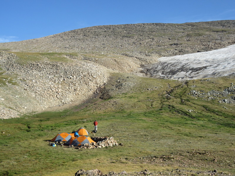
Camp 1 on Froze-to-Death plateau.
After breakfast on Mon 8 Aug, we packed up camp to continue across Froze-to-Death plateau. As we continued to the southwest, the terrain became progressively more talus and less tundra. The weather stayed kind all day. At about 3 pm, we set up camp a little before the far edge of the plateau, in rocky and really kind of bleak terrain, probably a little below 12000 ft. From our campsite, we could see the tip of Granite peeking above the plateau, it looked imposing.

Camp 2 on Froze-to-Death plateau. The summit of Granite Peak is visible at the upper left.
We checked out the views near camp until around sunset, then went to bed to try and get some rest before the efforts tomorrow.
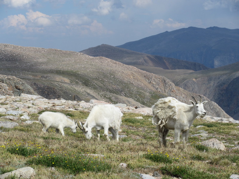
The mountain goats were quite friendly around camp 2.
We woke up on Tue 9 Aug at around 2:30 am. After fueling and hydrating, we went on the move by 3:40 am, and started across the talus to the edge of the plateau. As we went over the edge of the plateau, we turned south to the left, and started descending towards the saddle between Tempest Mountain and Granite Peak. There were some spots where there was a trail, but mostly we were just walking across boulders, following Nadav and Cat. At about 5:00 am we reached the saddle, at the base of the East Ridge of Granite, and took a break as the first hints of light came into the sky. We went a little beyond the saddle, then turned right and started ascending fairly steep and sometimes loose talus, up the East Ridge. There were a few dark clouds in the sky that looked like they could become trouble, but they never amounted to anything. Just before 7:00 am we reached a notch, and past this we got our first views of the technical section on the upper mountain.
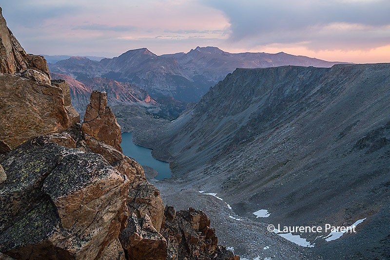
Looking north at twilight colors as we ascend the East Ridge. 6:30 am.
Photo by Laurence Parent.
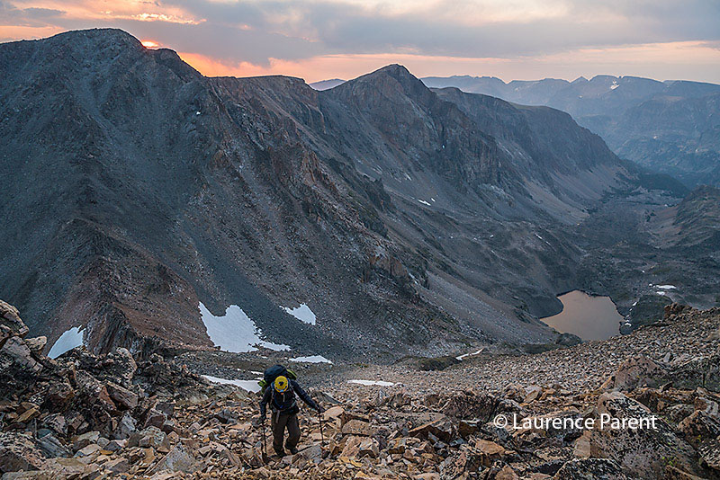
James hiking up the upper part of the talus below the notch.
Photo by Laurence Parent.
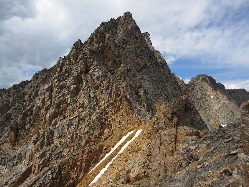
The upper part of Granite Peak. The technical section started here. (Photo taken later in the day.)
We put on our harnesses and roped up here. We made two rope teams, with Nadav, Roger and James in one, and Cat, myself and Laurence in the other. Nadav's grouped headed out first, and we followed just after. We walked along a ledge, which was a little bit rotten, and came to the infamous 'snowbridge'. There was no snow on the path this day, just loose dirt. There were some snow patches on the slope below, but none that we had to cross. Just past the end of the snowbridge, the actual climbing began, up a left leading crack. This first crack had some loose rock, so we took care.
On the harder sections, Cat would climb first, basically unbelayed, and then set an anchor at the top. Then, Laurence and I would follow simultaneously, so that there was little slack in the rope between us. Once we climbed this first crack, we continued with another similar one. The route at this point consisted of belayed pitches like this, with unbelayed walking or easy climbing in between. The middle third of the upper mountain was the hardest part, and had most all of the fifth class moves. We had one place where we had a short traverse to the right across a blank face. There were some convenient steps for footholds, and we used protection here to guard against a pendulum fall.
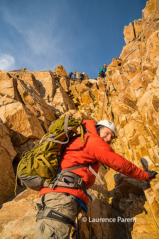
Me about to start climbing the first pitch.
Photo by Laurence Parent.
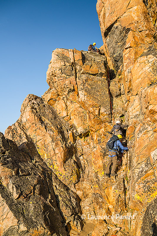
Roger and James climbing the second pitch.
Photo by Laurence Parent.
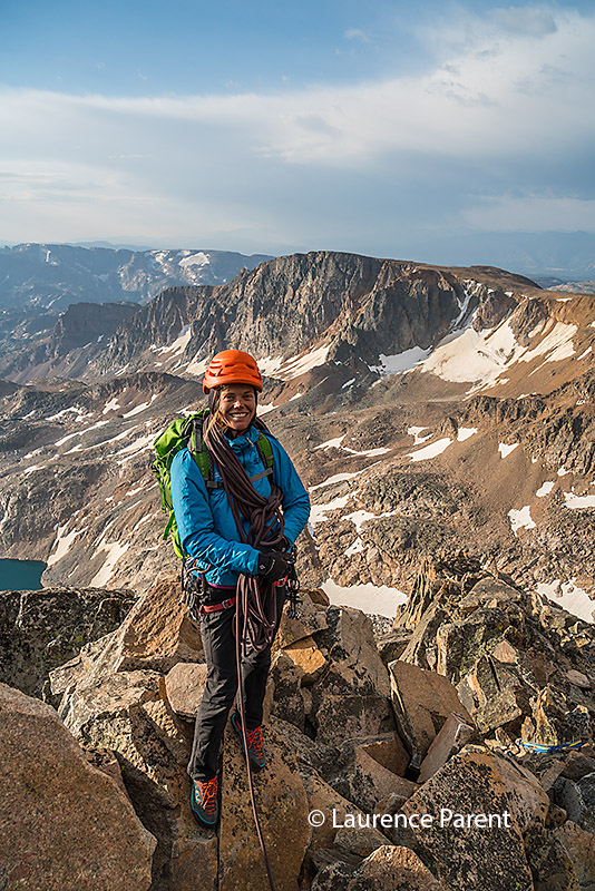
Cat Coe high on Granite Peak.
Photo by Laurence Parent.
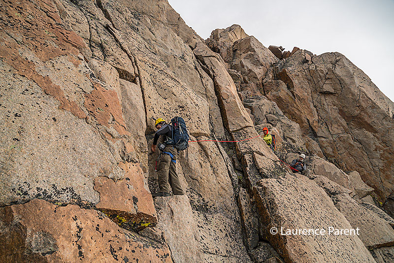
James follows Roger on the short traverse.
Photo by Laurence Parent.
A little bit after this was probably the most difficult section. Cat led off to the right a bit, and then myself and Laurence climbed up a short chimney. There were multiple chimneys, and we may not have chosen the easiest one. There was a good bit of lichen on the sides, and I had a tough time stemming myself in the chimney to move up. I fell several times, right down on Laurence who was close behind me. Finally I took my pack off, and sent it up to Cat, and then I could make progress upward. All I needed was about one foot, as after this, there was a wonderful chockstone in the chimney that made a superb hold, and the rest of the move was very easy. The start in this chimney was perhaps a 5.7 or 5.8 move. After this, there was maybe one more protected pitch, and then we came around a keyhole feature. All we had left was a short easy scramble to the summit area, which we reached a little before 9:30 am.
The highest point was to the left of where we came up this last section, with a larger more convenient rest spot to the right. The very highest natural point was very precariously located, with the sheer North Face below. Nadav discouraged anybody from standing on this exact point, but I made sure to at least sit on top of it. There were some rocks piled up just to the side of this, which were a more sensible place to stand. As we all enjoyed the views, photos, and snacks, another climbing team joined us on the summit. They had come by a different route, the Southwest Ramp. This route does not have the fourth and fifth class climbing that Granite does, but this group found the route loose and dangerous, and did not recommend it. After a nice long rest break, we started to carefully descend our route.
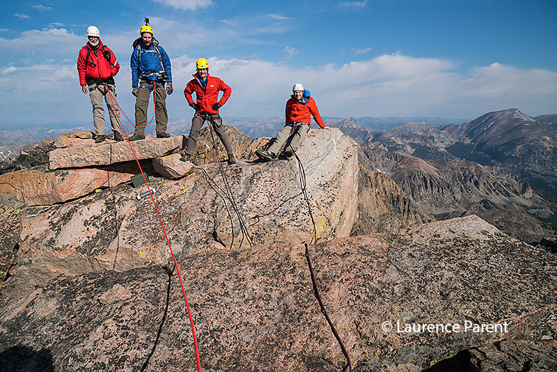
L to R, Roger, James, Laurence, and I on the summit block.
Photo by Laurence Parent.
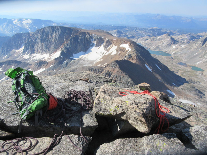
View from the summit of Granite Peak.
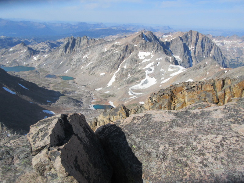
View from the summit of Granite Peak.
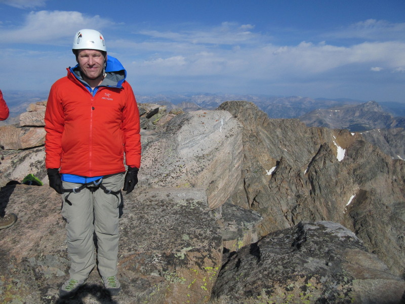
Me just in front of the highest point.
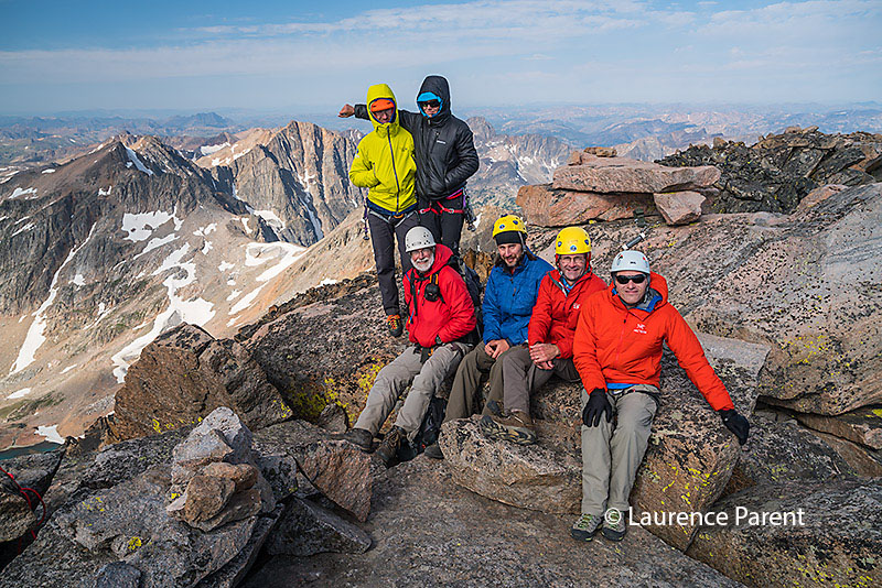
L to R, in back Nadav and Cat, in front Roger, James, Laurence, and I, just in front of the summit.
Photo by Laurence Parent.
We downclimbed most of the route, but in a couple places, Cat lowered Laurence and I on the rope. It was a little awkward to have two people lowered at once, but it worked well enough. Eventually, we returned to the base of the first technical crack, then walked above the remains of the snowbridge, across the curving ledge, and back to the notch where we had first roped up. Here we took off the ropes and harnesses, and took a rest break, around 12:30 pm.
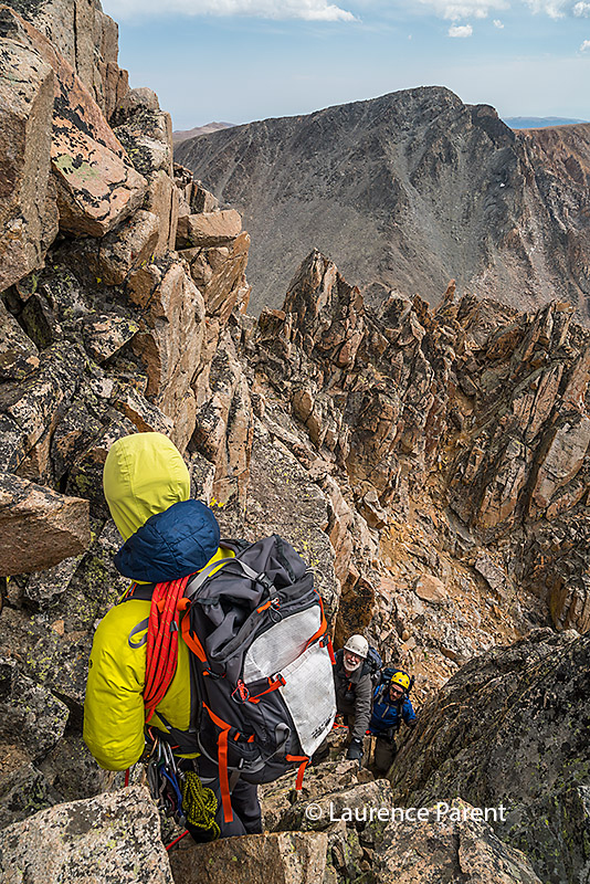
Roger and James descending while belayed by Nadav.
Photo by Laurence Parent.
We then descended the tedious talus back to the saddle, and then started back up to Froze-to-Death plateau. The views of Granite from this part of the route were fantastic. We could not see this view in the dark early morning, and on the approach hike we had just seen the tip of the peak, so this was really the first time that we had seen the impressive North Face. The hike up to Froze-to-Death plateau took a lot out of me. I felt in good shape at the saddle, but I was quite tired by the time I finally got back to the plateau. Besides the altitude gain, the mental effort it takes to choose your path through the rocks is also tiring. Many of the use trails led up too high, above the angle that we wanted to follow, so they seemed to waste as much time as they saved. There were several 'false' plateau edges on the way, and I was happy to reach the real plateau at last. I took a nice long break here, then slowly walked back to camp.
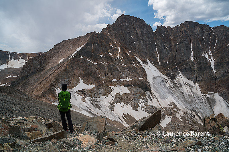
Looking up to the North Face of Granite Peak, from a bit north of the saddle with Tempest Mountain.
Photo by Laurence Parent.
We woke up fairly early on Wed 10 Aug, around 6:15 am, since we had a long way to walk out. It was pretty windy and chilly in the morning as we took down camp. Then we started the long hike back across the talus of Froze-to-Death plateau, reaching the end of the plateau, and the actual footpath, around 10:45 am. After a relaxing rest break alongside the trail, we continued down the switchbacks on the good trail to Mystic Lake. Not far above the lake, a black bear ran across the trail in front of us, but it was not looking for any trouble, and left us alone. We reached the end of the lake around 1 pm, and took some group photos. Then we continued on, with one last bit of rocky trail uphill from the lake, and then soon arrived back at the trailhead. Back at the trailhead, we returned our group gear, tipped our guides, and then drove away on the washboard roads.

The group in front of Mystic Lake. L to R: Al, Nadav, Chris, me, Roger, James, Cat, Laurence.
Photo by Laurence Parent.
In Roscoe we stopped at the Grizzly Bar and Grill in Roscoe for a burger and beer. Where the hell is Roscoe? The good burgers and beers really hit the spot after a few days on the trail. Highpointers should not miss this after-climb reward. Then it was time to drive on to Red Lodge, and clean up for real. The Highpointer Club convention would start the next day.
References
Granite Peak, Montana's Highest Point, A Climbing Guide. First Ascent Press.
This well-annotated map has excellent descriptions and photos of this and other routes on Granite. Now out of print.
Highpoint Adventures, Charlie and Diane Winger, Colorado Mountain Club Press, 2002.
Highpoints of the United States, Don W. Holmes, University of Utah Press, 2000.
http://www.jackieandalan.com/graniteroute.html - A good route description.
http://www.themountaininstitute.com/reports/montana/granite.html - Trip report by Jason Halladay.
http://climber.org/reports/2012/1809.html - Southwest couloir/ramp route description by Steve Eckert.