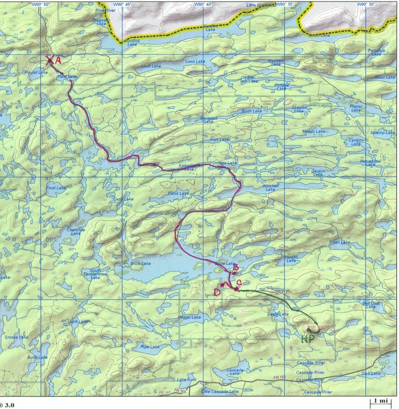
Overview of proposed route.
Minnesota Highpoint - Eagle Mountain - 2301 ft
Summit NOT reached!!
See the map below for the proposed route. The canoe path is marked in red, the hiking path in green. We put in at the X labeled A, which is near a road, near Ham Lake. From there, we travel (canoeing through small lakes with portages in between) southeast to Long Island Lake. From there, we continue east through more lakes, to the eastern end of Omega Lake. There, we cut south, into the fairly large Winchell Lake, then further south, followed by travel back to the west. We then turn south and head towards large Brule Lake. We then travel southeast across Brule Lake, camping at a designated spot labeled B, on an island in the southeast corner of Brule Lake. This is estimated at 3 or 4 days of paddling/portaging.
Summit Day - Wake up in out campsite at B, then canoe south 1 mile or so to C, where we land. From there, we hike southeast for 200 m or so until we reach the Brule Trail. This might possibly be a bushwhack, but there is probably some kind of trail. After joining the trail, we hike generally southeast until we join the spur trail to Eagle Mountain. (At this point we will intersect the normal route, which comes from the south of Eagle Mountain.) Then we head west, and up, to the highpoint. We then retrace the hike to the canoes, then paddle west along the shore to a road and our take-out point.
Total length of trip - 4 or 5 days. Best time of year - probably early-to-mid October.
We will start near Canada (the grey part at the top of the map is Canada), but I don't think starting the trip from over the border would work. One, there are likely legal problems. Two, I don't see any lakes to make extending the route straightforward. We will need to hire an outfitter, both for the canoes, and to put us in and pick us up at two different spots. We will want to make sure we get good canoes for this kind of work, namely reasonably light and with good yoke, to make carrying the things reasonable. I have not investigated any outfitters yet.

Overview of proposed route.

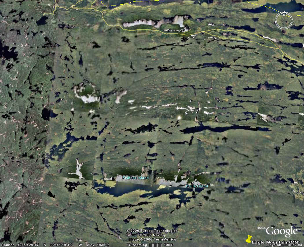
Satellite Photo of Area
References
Boundary Waters Canoe Camping, 2nd edition. Cliff Jacobson. Globe Pequot Press.
http://www.bwcamaps.com/
- McKenzie maps
http://www.wafishermn.com/maps/ - Fisher maps
http://www.kek.org/maps/bwcawmap3.gif - A map of the lakes near Eagle
Mountain
http://www.rutabaga.com/manufacturer.asp?mid=247 - A canoe retailer with
maps
http://www.bwcaw.org/ - Official BWCAW site, with info about permits
http://www.canoecountry.com/ - Links to many outfitters
http://www.bwca.cc/ - An outfitter, no idea if
they are good or not
http://www.bwca.cc/activities/hiking/eaglemountain.html - A brief hiking description
References for specific planning:
http://www.bwca.com/index.cfm?fuseaction=outfitting.outfitters - Links to several outfitters. I contacted three to begin with:
http://www.bwca.com/index.cfm?fuseaction=outfitting.ofdetails&busid=93&buslink=1
- Boundary Country Trekking
http://www.bwca.com/index.cfm?fuseaction=outfitting.ofdetails&busid=73&buslink=1
- Clearwater Canoe Outfitters & Lodge
http://www.bwca.com/index.cfm?fuseaction=outfitting.ofdetails&busid=102&buslink=1
- Gunflint Northwoods Outfitters
end