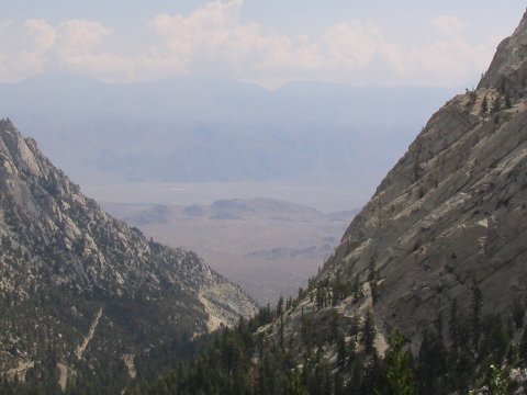
Looking down on Whitney Portal, soon after we start our hike. We are already 5000 feet above Lone Pine, in the valley below.
California Highpoint - Mount Whitney - 14494 ft
26 July 2005, 9:50 am.
Highpoint #36.
Back to 2005 Californium
Expedition
Hiking Mount Whitney (by the Main Mount Whitney Trail, anyways) is not an experience of wilderness solitude. Lots of people want to hike to the top of this highest point in the lower 48 states. I did too, so I was as guilty as everybody else for the crowding. There are plenty of people everywhere along the trail, and you are rarely out of sight of others, but it never felt unbearably crowded.
With the crowds, come plenty of rules. The main one is that you have to have a permit to hike the trail, and only a very limited number are given out. I applied through the lottery in February, and got my first choice of 3 days for 4 people. We were lucky, I talked to another group who got nothing at all in the lottery. They did manage a walk-in permit, which is the other option for getting a permit. Besides that, there are rules about no campfires, no cutting switchbacks, food has to be kept in bear-proof canisters, and you are requested to pack out your own poop in 'Wag Bags'. (There was a sign along the trail specifically noting that you are welcome to leave your pee behind.) Everyone has to display a tag on their backpack, with different colors for different types of permits. We saw yellow tags for overnight hikers (like ourselves), green tags for single day hikers , and pink tags for exit-only permits. We expected to be repeatedly challenged by rangers, asking us to present our papers. As it turned out, we only saw one ranger the whole time, walking though Trail Camp, and he never came and talked to us.
We rented our required bear canisters at the Whitney Portal store, for $2 per day per canister. They had plenty available. We hoped to get everything into just 2, but ended up using 3. We were curious about how many bears really prowled as high as Trail Camp at 12000 ft, but the store did have many interesting photos of bear-trashed cars at the trailhead, including a particularly cute shot of a bear poking its head out of the SUV it had just ripped open. You are not allowed to leave food (or toothpaste, or deodorant, etc.) in the car, at any time, but there are communal lockers that you can stash such smelly items in during your hike.
This all is quite a contrast from Boundary Peak NV, where we saw hardly anybody and saw no rules (or anything else) posted at all. We ran into at least two groups of hikers that were doing both peaks, and I think they made a nice combination. I thought Boundary was somewhat harder, although less of a physical effort than the 6000+ foot elevation gain on Whitney.
On the 24th, the four of us, Jim Buckley (Colorado), John Gallen (Pennsylvania), along with Tom Buckley (Mexico City) and myself (Mark Kness, Austin) drove south from Bishop to Lone Pine, where we stopped at the ranger station. After handing us the Wag Bags, and reminding us of the rules, the rangers gave us our official permit. Then we drove up the road to the car campground at Whitney Portal. We didn't have a campground reservation, but we didn't have trouble finding an open spot. We set up the tents while stashing all the food and other smelly items in the armored bear-proof locker. We rounded out the evening by watching the second half of Hang 'em High on John's laptop, followed by silly penguin jokes.
The next morning, we took down camp, drove the short distance to the Portal Store, stored our remaining food in the lockers, and started up the Main Mount Whitney Trail. We all weighed our packs on the scale, we had around 44 lbs each except for Jim who had just 36. (It probably isn't a coincidence that Jim was the one without a bear canister.) The trail is an easy, steady grade as it starts up from 8360 ft at Whitney Portal. There were a few stream crossings to negotiate on the trail, with the trickiest ones first, but we all stayed dry.

Looking down on Whitney Portal, soon after we start our hike. We are
already 5000
feet above Lone Pine, in the valley below.
Our permits were marked for Outpost Camp, but we were told that we could camp at any designated campground. After reaching Outpost Camp, we decided to continue on to Trail Camp. We still had plenty of time and energy, and there were supposed to be fewer mosquitoes at the higher camp. The trail between the two camps is reasonably steep, but easy to follow. There was a short stretch of snow just before Trail Camp, but almost all of the trail was clear. Lugging the full packs up to Trail Camp was a decent bit of extra work, but it did made the next day easier. There is no privacy at Trail Camp, but Outpost Camp wouldn't have been much better. At Trail Camp, we picked out two adjacent sites, set up the two tents, and eventually got around to filtering water and cooking dinner.

During a rest break, the high peaks loom through a gap in the walls.
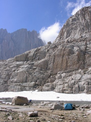
Trail Camp.
Tom and I woke up to our alarms at 4 am on the 26th. I quickly started boiling some water, for hot drinks for breakfast, and got my gear ready for the hike. John and Jim, in the second tent, didn't seem to want to get up so soon, I don't think they had stirred by 5. I was starting to wonder if they wanted to go to the top or not. Eventually, they got up and started to prepare. Meanwhile, I had some time to take some photos of the changing morning light. By 6, I had been standing around so long that I started towards the switchbacks alone, and the rest of the crew finally got on the trail by 6:15.
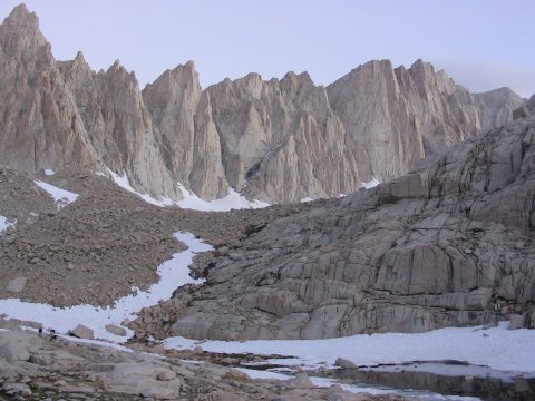
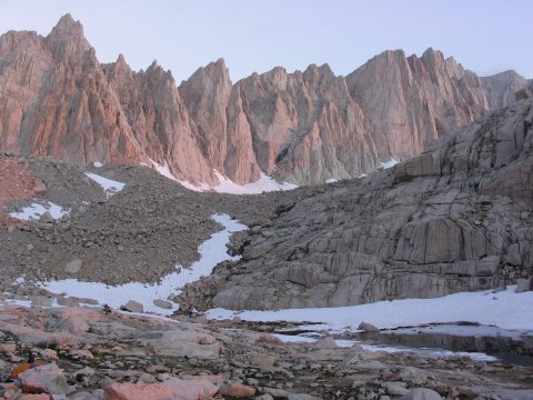
While I wait for everybody to wake up, the light changes nicely on Whitney.
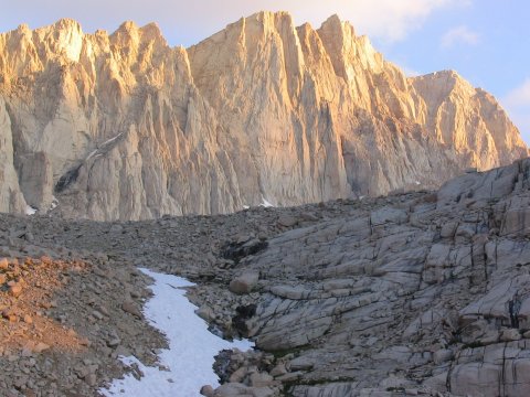
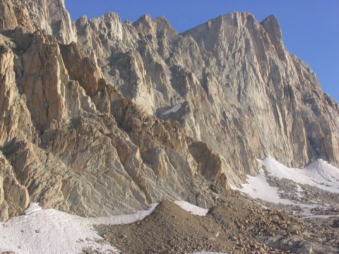
FINALLY we all get going, and start up those switchbacks. The colors are
still nice.
Our first task of the day was to ascend the '98 Switchbacks' up to Trail Crest. The trail was easy all the way up this section, with the biggest problem being snowmelt which made much of the lower section wet. The switchbacks were practically free of snow all the way up, including at the 'cables' section. This went quickly enough, and we were soon at Trail Crest where the trail crosses over to the west side of the ridge that leads to Whitney's summit. As soon as we made it there, at 8 am, a stiff breeze cooled me down, so I put on a second layer. From here, the trail descends a bit, then meets the John Muir Trail, then follows the west side of the ridge, north towards Whitney. There are still 2.5 miles to go after reaching Trail Crest, so this did take a little while. The trail, rockier and somewhat more exposed than in the switchback section, winds around pinnacles, and occasionally provides a 'window' down onto the basin to the east, 1500 feet or so below.
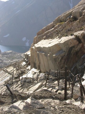
The trail near the cables is free of snow.
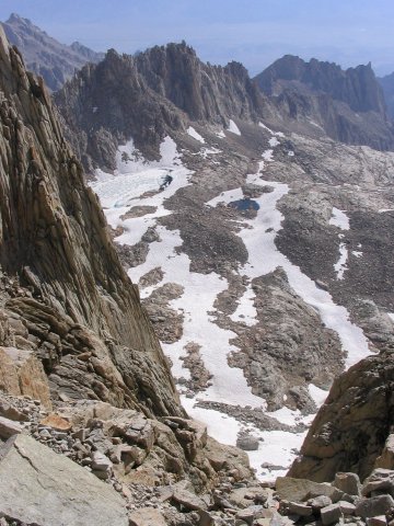

Some of the 'windows' on the upper portion of the trail above Trail Crest. Don't fall here!
Near one of these, we took a rest break. As we started up afterwards, John broke out quite the hat, which none of the rest of us had seen yet. It seems that, late in the spring of 1980, when John was a teenager, he and a friend were camping in Pennsylvania. They were having a good time, lying in hammocks across a stream, on the Appalachian Trail. Then, along came some bedraggled hikers out of the trees - they had been without water for over a day, as their intended source had been dry. Needless to say, this was a happy encounter for these beleaguered hikers. Years later, while in college, John and Russell Taichman, one of the thirsty hikers, happened to meet again. At first, they did not recognize each other, but eventually, the conversation turned to an encounter with some teenagers giving them lifesaving water, and they realized that they had met before. In gratitude, Russell hand carved the horns for a Viking hat, stapling them onto the cap, giving it to John. So this was now the lucky hat!
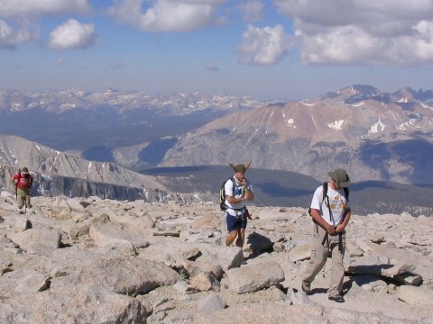
Getting up after one last rest break before the summit - But what's that on
John's head?!
The next group of hikers on the trail were a couple of Highpointers from Wisconsin. They were concerned that they had stumbled across a den of Minnesota Viking-dom. When we told them that the hat was just about Vikings in general, not the NFL Minnesota Vikings, they seemed reassured. We continued north on the trail, with the final obstacle now in view.
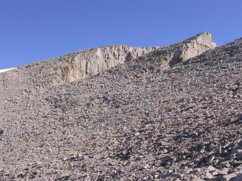
The final leg of the hike. Almost there!
Shortly afterwards, the trail started to ascend onto the shoulder behind Whitney's summit, crossing another snow patch, and then uphill to the east. Soon, we passed the hut and reached the flattish boulder pile at the top. Every other boulder seemed to have its own USGS marker, so we picked out our own candidates for highest of the bunch and made sure to stand on all of those. Until this point of the trip, we had the summits to ourselves for around an hour each time. Not so here, there were plenty of other hikers on top.

Highest point in the lower 48 states.
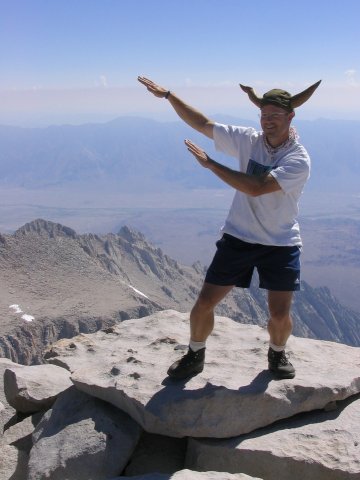
John Gallen crushes all competition in the high-altitude silly hat contest!
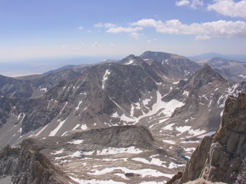
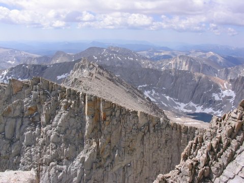
Summit views.
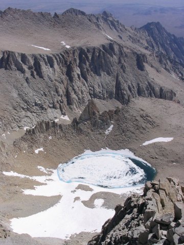
Looking down on Iceberg Lake.
Around 11 am, just over an hour since we got there, we started back down. On the way down, Jim and I counted the switchbacks. I wasn't very reliable at this, I kept getting stuck on 56. However, my final count was actually 98 switchbacks, matching my californium theory. When we returned to camp around 3 pm, we had a very unpleasant discovery - the Viking hat was missing! John had left it after a rest break, back up on switchback 69 (counting down from the top.) We can't leave one of the party behind! So, John runs back up the lower part of the switchbacks, finds the rest spot, finds the hat, puts it on and then charges back down the switchbacks again. The rest of us, watching the 'ants' go up and down the trail from Trail Camp, got a lot of laughs imagining what the tired hikers thought of a man wearing a Viking hat charging past them. Shortly, John and the Viking hat are both back safely.
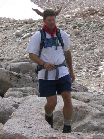
The Viking hat returns safely to camp.
The next day, we had a more leisurely wakeup, then packed up and headed back down to Whitney Portal. There was still time for some photographs, but the return went quickly, and we were soon back to the Portal.
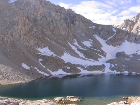
Consultation Lake.
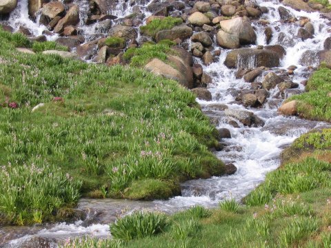
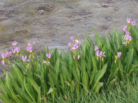
Trailside Meadow.
John had to leave the group to travel to Yosemite, and he departed Whitney Portal in fine style, with the Viking Hat on in his top-down convertible as he drove away. Tom, Jim and I instead headed towards Death Valley, the lowest point in the USA, and the hottest place in the world.

A tiny crystal of the bromide of
californium, element 98. One proton per switchback.
References
Highpoint Adventures, Charlie and Diane
Winger, Colorado Mountain Club Press, 2002.
Highpoints of the United States, Don W.
Holmes, University of Utah Press, 2000.
http://www.summitpost.org/show/mountain_link.pl/mountain_id/45
http://www.summitpost.org/show/mountain_link.pl/mountain_id/359